Hiking in Croatia: the best trails, parks and practical guide
Split: Krka National Park tour
Is Croatia good for hiking?
Yes — Croatia has excellent and underrated hiking across five distinct zones: the Dinaric karst mountains (Velebit, Biokovo), the national park canyon systems (Paklenica, Risnjak), the forested islands (Mljet, Brač), the Istrian interior and the Gorski Kotar highlands. Trails are generally well marked, infrastructure is improving, and the scenery is often exceptional.
Croatia is not the first name that comes to mind when European hiking is discussed — Italy, Switzerland, Slovenia and Austria tend to occupy that space. The oversight is significant. Croatia’s karst limestone mountains produce some of the most dramatic scenery on the continent, the trails from Paklenica to Risnjak are well marked and increasingly well serviced, and the possibility of combining summit hiking with Adriatic swimming in the same day is rare anywhere in Europe.
This guide covers the main hiking destinations, graded by difficulty and character, with practical access information.
The five hiking zones of Croatia
1. Velebit Range — the longest mountain range in Croatia, running 145 km along the coast from Senj to the Krka river canyon. Subdivided into North Velebit (national park) and South Velebit, with Paklenica National Park at its southern end. Velebit offers everything from day hikes to multi-week traverses.
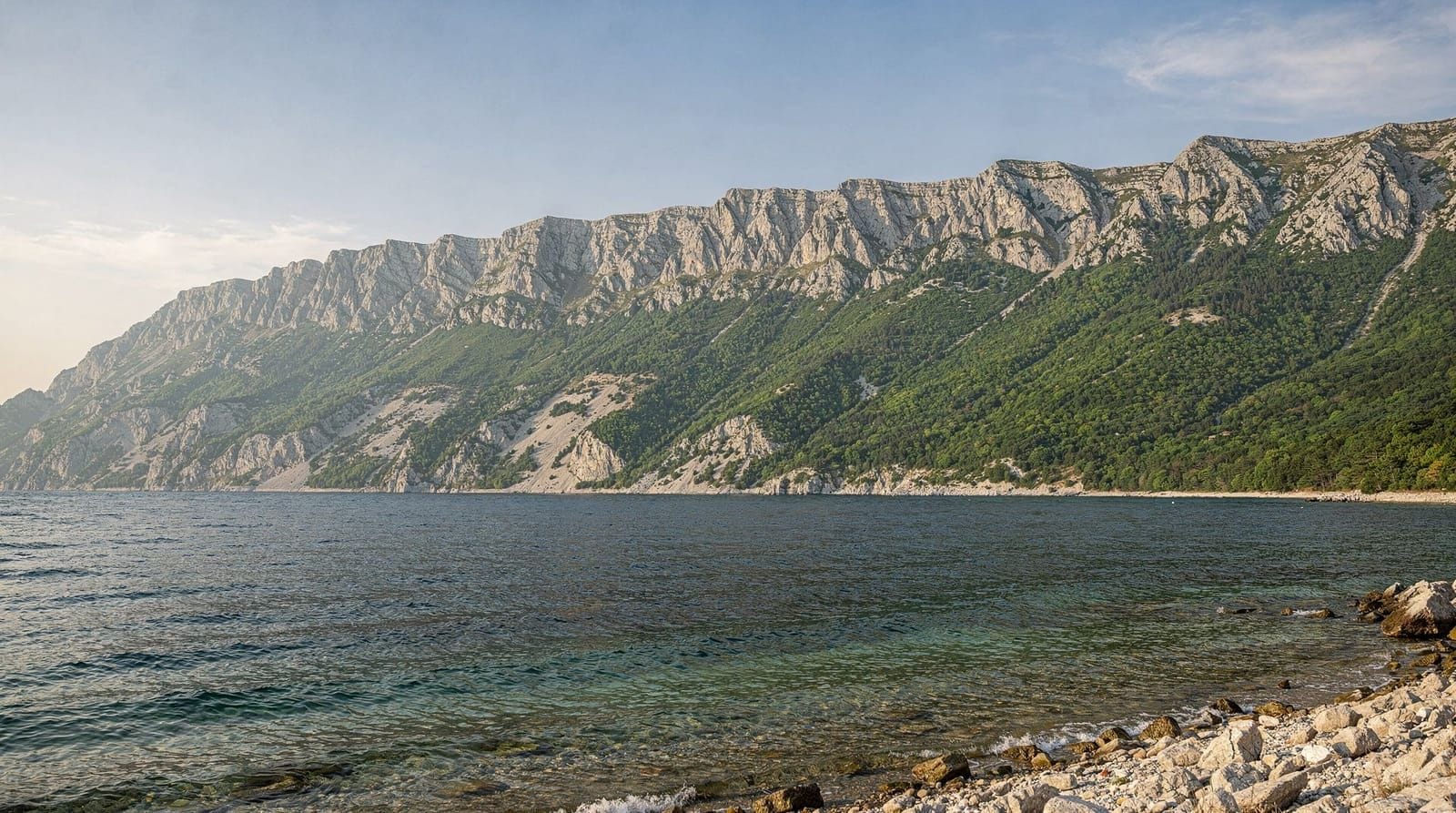
2. Biokovo — the coastal massif behind Makarska, rising to 1,762 m over a very short horizontal distance from the sea. Dramatic, hot in summer, excellent views.
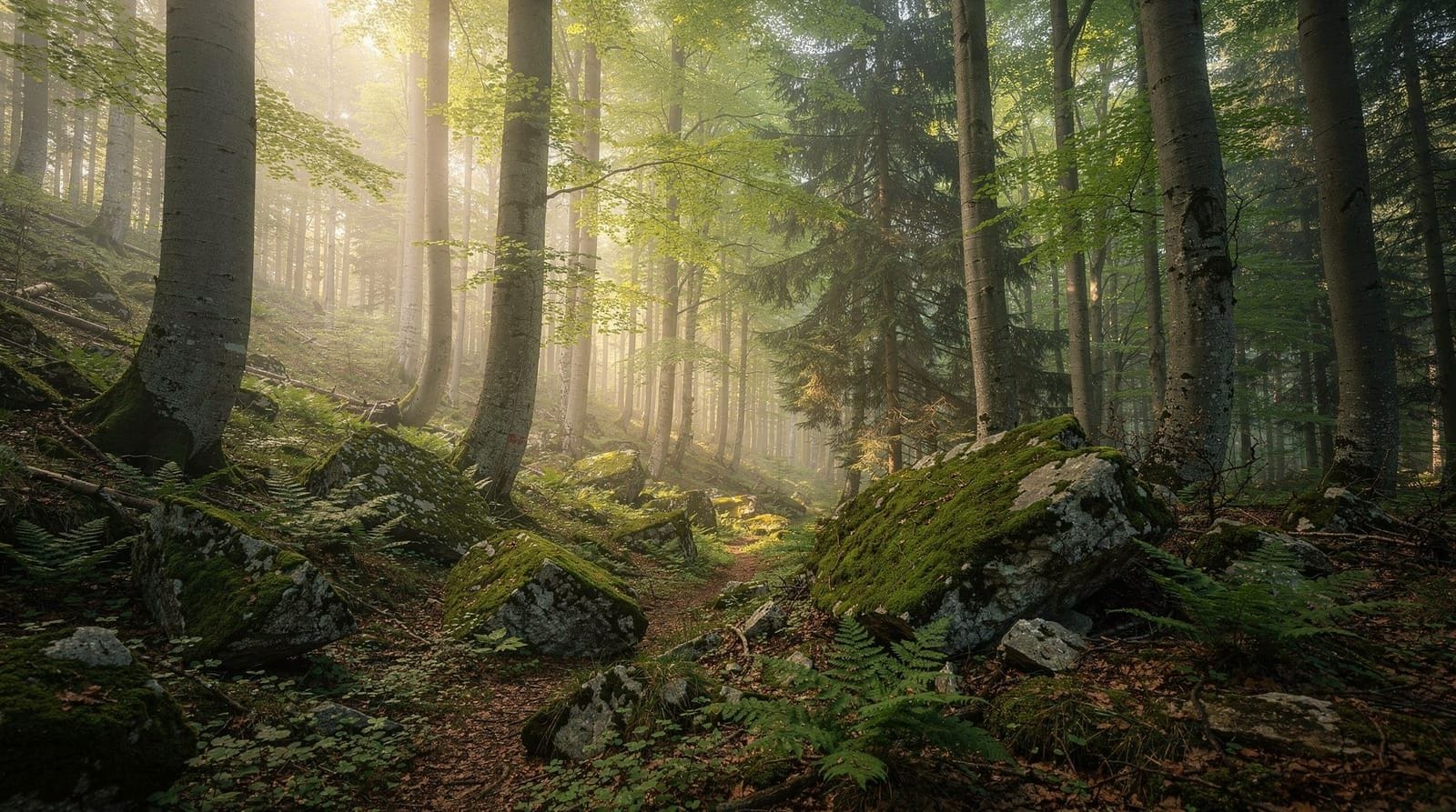
3. Gorski Kotar — the inland mountain area between the coast and Zagreb, including Risnjak National Park. Dense forests, karst sinkholes, cooler climate, less visited.
4. Plitvice and Karst Interior — more walking than hiking, but the boardwalk systems and riverside trails in the karst valleys are pleasant for non-technical visitors.
5. Island Hiking — Mljet, Brač, Hvar and the larger islands have marked trails through their interiors. Not high-altitude, but pleasant coastal walking with good swimming access.
Paklenica: best for serious hikers on the coast
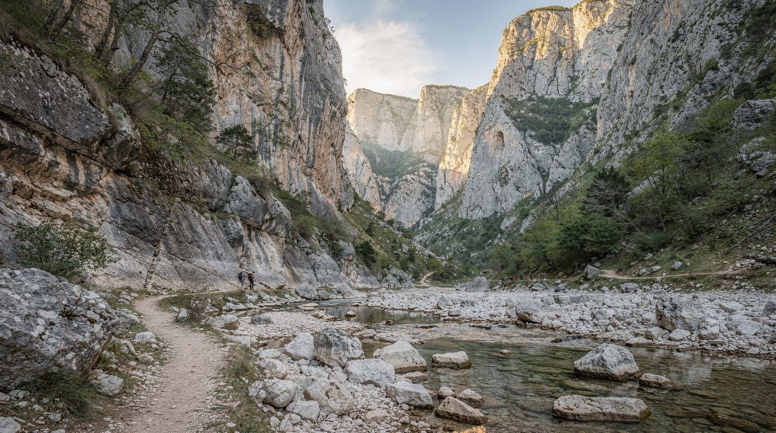
Paklenica National Park is the natural starting point for any discussion of Croatian hiking. The canyon system provides immediate drama — a gorge rising several hundred metres in a few kilometres of walking — and the route to Vaganski Vrh (1,757 m) from the canyon entrance is a legitimate mountain challenge: over 1,600 m of elevation gain, several hours of exposed ridge walking, and conditions that require proper preparation.
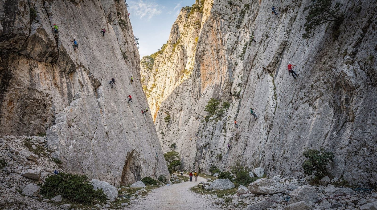
The canyon trail itself (to Dom Paklenica hut, 4.5 km) is accessible to fit general visitors and gives enough of the landscape to satisfy most. Rock climbers get the Anića Kuk wall — 400 routes, internationally recognised, the main reason many visitors choose Paklenica over anywhere else.
The park is accessible from Zadar in 45 minutes and can be day-tripped from Split in 1.5 hours.
Biokovo: the most dramatic elevation change
Standing on a Makarska beach, the limestone wall of Biokovo rising almost vertically behind the town is one of the most compelling visual invitations in Croatia. The park’s highest point, Sveti Jure (1,762 m), is Croatia’s second-highest peak, and the views from the ridge — across the islands to Italy on clear days — justify the effort.
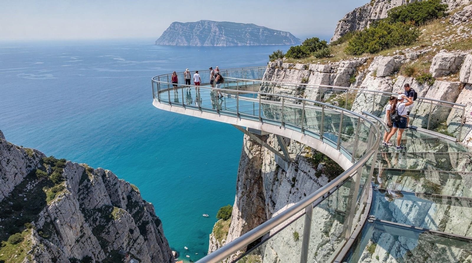
The approach by mountain road (driveable) reduces the hiking commitment for those primarily after the view. The Biokovo Skywalk at 1,228 m adds a specific viewpoint focus. For those who want to hike rather than drive, routes climb from Makarska and the coastal villages directly up the escarpment — strenuous, rarely flat and very rewarding.
In July–August, carry substantial water — the exposed limestone holds no shade for long sections and temperatures at sea level exceed 30°C.
Velebit: Croatia’s great mountain wilderness
The full Velebit massif is where Croatian mountain hiking becomes genuinely serious. The range divides into three areas:
Sjeverni Velebit (North Velebit National Park): Protected in 1999, this covers the northern section including the dramatic Hajdučki kukovi and Rožanski kukovi rock formations — towers and ridges of eroded limestone rising from alpine meadows. The Lukina jama cave system descends over 1,400 metres, one of the deepest in the world. The Zavižan mountain hut and botanical garden is the most accessible entry point.
Srednji Velebit (Middle Velebit): The Premužić Trail — a 57 km waymarked path along the ridge — is Croatia’s most famous long-distance hike. Constructed in the 1930s, it crosses the full middle section of the range on a superb engineering achievement: a built path with consistent gradient, mountain hut rest points and excellent views on both sides. Multi-day completion takes 3–4 days.
Južni Velebit (South Velebit) and Paklenica: The southern section terminates in the Paklenica canyon system, creating a natural multi-day circuit from north to south (or south to north) for those who want to traverse the full range.
The Velebit Nature Park guide covers the wider range.
Risnjak: the forested mountain park
Risnjak National Park in Gorski Kotar is the most accessible alternative to Velebit for visitors based in or near Rijeka or Zagreb. The park’s highest point, Risnjak peak (1,528 m), is reachable on a well-marked day hike from the Bijela Vodica entrance. The landscape is dense beech and fir forest — very different from the barren limestone of Velebit or Biokovo — with karst sinkholes, springs and the headwaters of the Kupa river.
The lynx (ris) population that gives the park its name is real but sightings require dawn-to-dusk patience. Bear and wolf are also present. The park has limited visitor infrastructure but the trail network is clear and manageable.
Gorski Kotar’s highland climate means cooler summers than the coast — a genuine advantage for hiking in July.
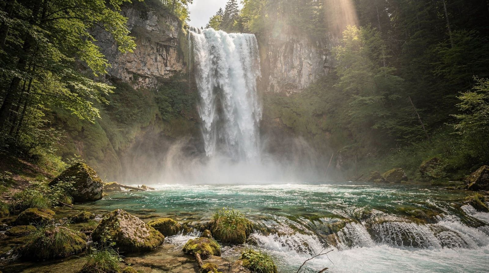
Plitvice and the karst interior: walking not hiking
Plitvičke jezera National Park is not a hiking destination in the technical sense — it is a boardwalk nature experience. But the park’s longer routes (H and K) involve 10–12 km of walking across varied terrain, and the surrounding Lika region has additional trails that extend beyond the park boundary.
The canyon systems around Plitvice — the Korana river gorge south of Slunj, and the forested valleys approaching from the north — are walker-friendly territory for those who want more time in the area.
Island hiking
Several of Croatia’s islands reward walking beyond their beaches:
Mljet: The western national park section has hiking trails through pine forest, around the saltwater lakes and to the chapel on the Soline peninsula. None of it is technical; all of it is pleasant.
Brač: The interior of Brač island, rising to Vidova Gora (778 m) — the highest island peak in the Adriatic — has marked trails and sea views that stretch to Hvar and the mainland mountains.
Hvar: The island’s lavender-covered interior has walking paths between villages and views over the Paklinski islands.
Essential hiking information for Croatia
Maps: The Croatian Mountaineering Association (Hrvatska planinarska saveza, HPS) publishes 1:25,000 topographic maps for the major ranges. Digital maps are available through apps including Viewranger and AllTrails for the main routes.
Mountain huts: The HPS operates a network of mountain huts (planinski dom) across the Velebit, Risnjak and Biokovo ranges. Bookings are managed through the HPS system and fill quickly for summer weekends. Most provide basic dormitory accommodation, blankets and meals.
Emergency: Mountain rescue is provided by HGSS (Croatian Mountain Rescue Service). Emergency number: 112. Mobile coverage is limited in the upper Velebit and Risnjak backcountry.
Water: The karst mountains have very limited surface water in summer — springs shown on maps may be dry by August. Carry more water than you think you need. Mountain huts are the main reliable water source.
What to wear: Good waterproof hiking boots for anything beyond national park boardwalks. Sun protection at altitude. A warm layer for ridgeline or summit routes where temperature drops 5–10°C relative to sea level.
Frequently asked questions about Hiking in Croatia
What is the best hiking destination in Croatia?
Paklenica National Park for canyon and serious mountain hiking; Biokovo for the most dramatic coast-to-summit elevation change with the best sea views; Plitvice Lakes for accessible boardwalk nature walking; Velebit for multi-day wilderness routes. The right answer depends on your fitness and the type of landscape you want.When is the best time to hike in Croatia?
May–June and September–October. Summer (July–August) brings heat that is uncomfortable for sustained uphill hiking, particularly on Biokovo and Velebit where shade is limited. Spring offers wildflowers, maximum waterfall flow and manageable temperatures. Autumn has the best air clarity and quietest trails.Are Croatia's hiking trails well marked?
Yes in the national parks and on major routes — red/white waymarkers follow the European standard and are reliably maintained on routes like the Paklenica canyon trail, Biokovo summit paths and the Plitvice boardwalks. More remote Velebit and Risnjak routes require navigation experience and a good map.Do you need hiking guides in Croatia?
For the main national park trails, no — they are accessible to independent hikers. For technical routes on Velebit's ridge system, the Risnjak backcountry and multi-day Dinaric traverses, a guide is strongly recommended. The Croatian Mountaineering Association (HPS) publishes maps and trail databases.What is the most challenging hike in Croatia?
The Velebit ridge traverse — a multi-day route across one of Croatia's great mountain systems — is the most demanding endurance hike. The approach to Vaganski Vrh from Paklenica (1,757 m) is the hardest single-day push accessible from the coast. The North Velebit backcountry around Hajdučki kukovi is technical and remote.Can you hike to the sea from the mountains in Croatia?
Yes — this is one of Croatia's great geographic advantages. From Biokovo, you can see the Adriatic from summit level and descend to Makarska's beaches in under an hour by car. From Paklenica, Starigrad's coastal town is 5 minutes from the park entrance. The contrast between mountain and sea is extreme and part of the appeal.
Top experiences
Bookable activities with verified prices and instant confirmation on GetYourGuide.
Top experiences
Best-rated activities across GetYourGuide and Viator.

From Split: Plitvice Lakes National Park Guided Tour
- Viator

Krka Waterfalls Day Tour with Boat Ride from Split and Trogir
- Viator

Plitvice Lakes National Park Guided Day Tour from Split
- Viator

Krka National Park Tour with tour Guide & Wine tasting from Split & Trogir
- Viator

From Zadar: Plitvice Lakes with Boat Ride & Zadar Old town tour
- Viator

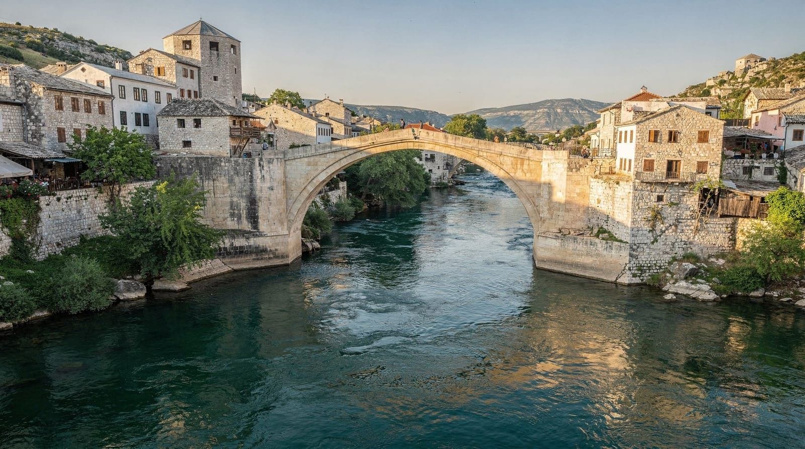
Mostar and Herzegovina Tour with Kravica Waterfall from Split & Trogir
- Viator